|
June 20, 2005
OIL & MINING Industries Stake
Claim
to MUCH of LOS PADRES NATIONAL FOREST
ANALYSIS
SHOWS INDUSTRY CONTROL OF MOST
PUBLIC LANDS IN THE WEST
A recent
investigation of 1,855 natural treasures in the West revealed
that oil drilling and mining interests control land in or near
more than two-thirds of national parks, forests, wilderness
areas, wildlife refuges, and other public lands. The Los Padres
National Forest has one of the highest rates of industry control
in the West, and the report comes at a time when officials are
finalizing their plans to open up new areas there to oil
drilling.
The
Environmental Working Group’s (EWG) computer analysis of
millions of federal land use records found that if present
trends continue, in 20 years no national park, forest, or other
natural treasure will remain free of industry control inside or
within five miles of its borders. Despite this widespread
access, 15 years of drilling and mining on public lands has
produced less than two months’ worth of current U.S. oil needs
and less than eight months’ worth of natural gas. In that
period, industry had access to more than 200 million acres of
Western public lands – an expanse nearly twice the size of the
state of California.
The Los
Padres National Forest has the highest rate of oil industry
control out of 333 areas of public lands in California. A
ForestWatch analysis of this report revealed that oil and mining
companies control more land in and around the Los Padres than
nearly any other area in the West. There are currently 50
active oil and gas leases and 153 mining claims in or near the
Los Padres, plus another 98 patents titled to the mining
industry, according to the report.
|
 |
|
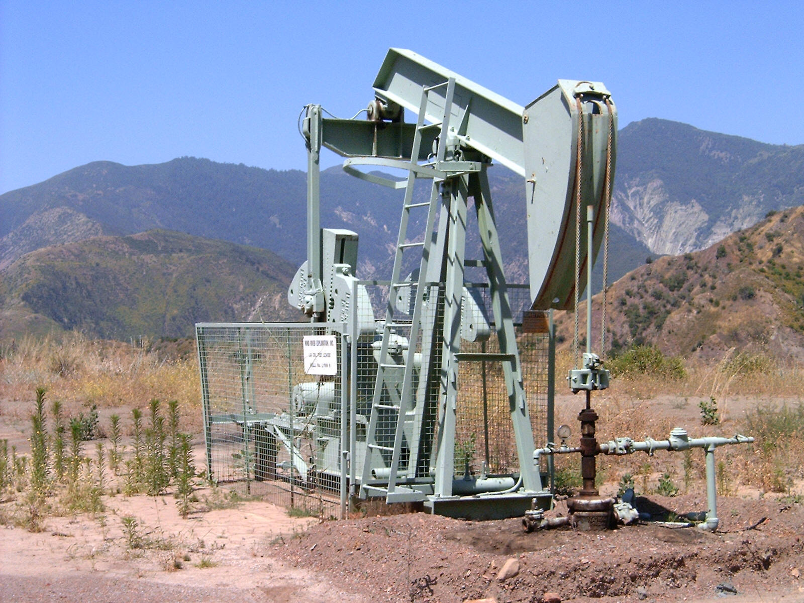
Sespe Oil Field, northeast of Ojai
in the Los Padres National Forest. © LPFW, Inc. |
“It is unacceptable that the Forest Service wants to expand oil
drilling in our national forest, when it is already suffering
from too much industry control,” stated Jeff Kuyper, executive
director of ForestWatch. The Forest Service is currently
preparing to open up to 52,075 acres of lands on the Los Padres
NF to new oil and gas drilling, which by the Forest Service’s
own admission would likely yield only a four and one-half day
supply of oil. “Allowing new oil drilling in the Los Padres
would propel the forest even further up the charts and subject
our public lands to even more industry plunder.”
EWG’s
interactive, web-based report allows the public to view maps and
see just who controls the land in or near public lands in 13
states. The report and maps – titled Who Owns the West?
Losing Ground – are available at
www.ewg.org/reports/losingground .
“These
natural treasures are an irreplaceable part of our nation’s
heritage,” said EWG analyst Dusty Horwitt. “But drilling and
mining interests already have greater access to public lands
than we do – and they still want more.” For decades, the oil
and gas and mining industries have complained that they are
locked out of access to public lands that could free the United
States from dependence on foreign energy sources.
This report
not only reveals that industry has substantial access to western
public lands, but also that this control encroaches on the
majority of America’s most treasured places. EWG’s
investigation, carried out over more than two years, found
well-documented harmful impacts up to 200 miles away from
drilling and mining sites. Damage to land and water, scenic
views, and wildlife calls into question industry claims that
access, once gained, will have modest and short-lived
environmental impacts.
Also ranked
highly in the report is the Congressionally-designated Sespe
Wilderness Area, located just north of Ojai inside the national
forest boundary, as well as 37 other pristine, roadless areas
located across the Los Padres NF. Other public lands listed in
the report include the Caliente Wilderness Study Area in San
Luis Obispo County, the Silver Peak Wilderness in Monterey
County, the Sespe Creek Wild & Scenic River in Ventura County,
and the Bitter Creek National Wildlife Refuge in Kern County.
ForestWatch
supports the report’s recommendations that the government should
protect the last few remaining pristine natural treasures from
new mining and drilling, to invest in energy efficiency to move
the nation towards clean, sustainable technologies, and to
impose a moratorium on oil and gas leasing on ecologically
sensitive public lands.
# # #
Los
Padres ForestWatch is a nonprofit 501(c)(3) organization working
to
protect and restore our public lands along
California’s Central Coast.
|