 
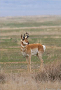
Home to the pronghorn antelope, North America's fastest animal
on land. California condors soar overhead. San Joaquin kit
foxes, giant kangaroo rats, and blunt-nosed leopard lizards
burrow underground, seeking refuge from the harsh elements. Not
to mention dazzling fields of wildflowers, Native American rock
art, a giant alkali lake, and the oldest section of the San
Andreas fault.
 These
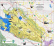
all converge on the Carrizo Plain, a vast expanse of golden
grasslands and stark ridges adjacent to the Los Padres National
Forest near the southeastern tip of San Luis Obispo County.
Often referred to as “California’s Serengeti,” it is one of the
last undeveloped remnants of the southern San Joaquin Valley
ecosystem. The Carrizo Plain is critical for the long-term
conservation of this dwindling ecosystem, linking these lands to
other high-value habitat areas like the Los Padres National
Forest, the Salinas Valley, the Cuyama Valley, and the Bitter
Creek National Wildlife Refuge in western Kern County. These
all converge on the Carrizo Plain, a vast expanse of golden
grasslands and stark ridges adjacent to the Los Padres National
Forest near the southeastern tip of San Luis Obispo County.
Often referred to as “California’s Serengeti,” it is one of the
last undeveloped remnants of the southern San Joaquin Valley
ecosystem. The Carrizo Plain is critical for the long-term
conservation of this dwindling ecosystem, linking these lands to
other high-value habitat areas like the Los Padres National
Forest, the Salinas Valley, the Cuyama Valley, and the Bitter
Creek National Wildlife Refuge in western Kern County.
Honoring the area's high
biodiversity, limited human impacts, and rare geological and
cultural features, the Carrizo Plain was declared a National
Monument in 2001, and now includes more than 206,000 acres of
public lands -
perhaps the largest native grassland remaining in all of
California.
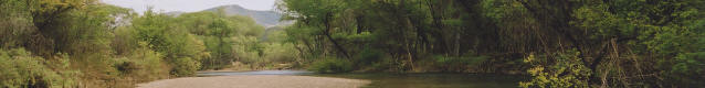
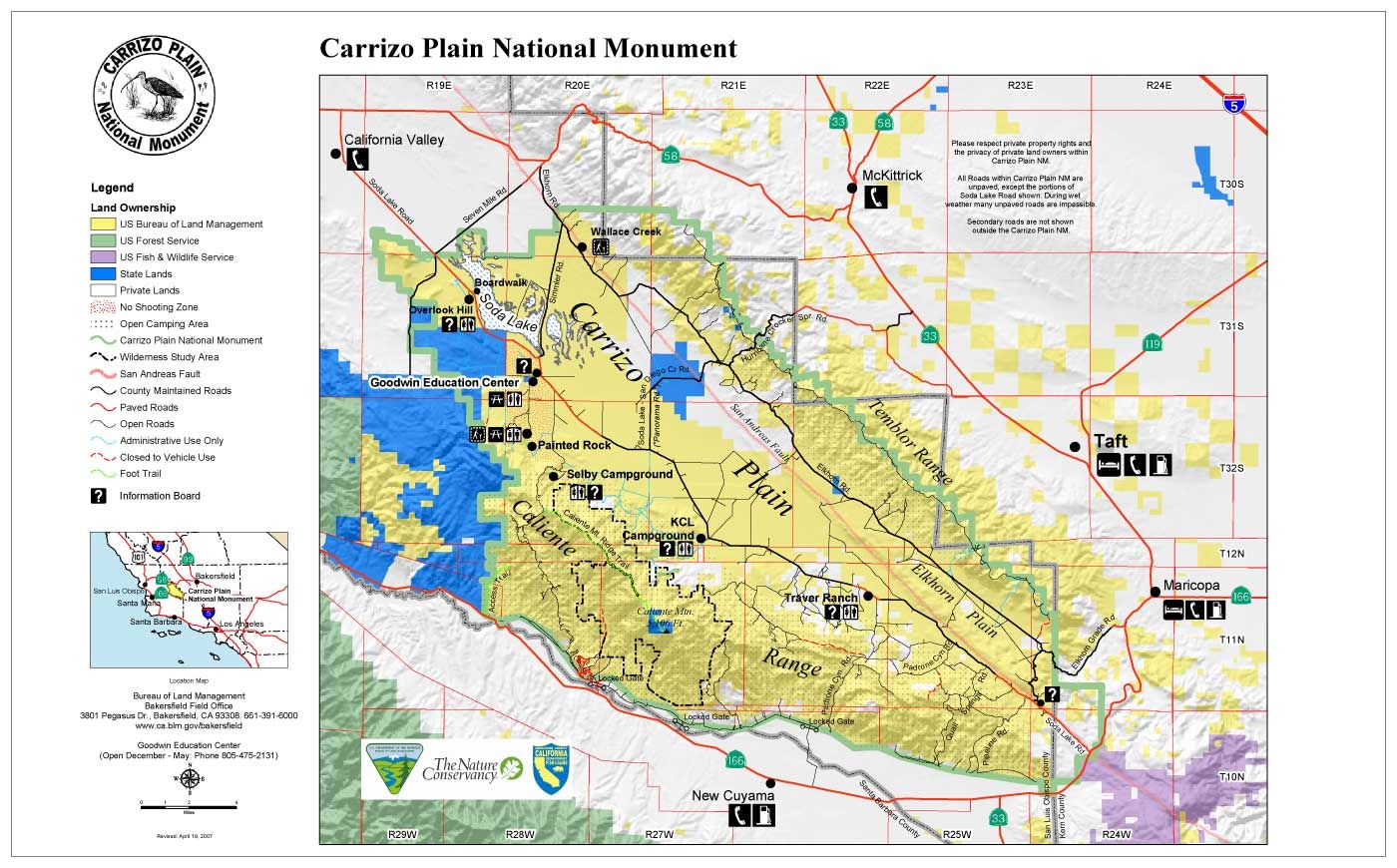
Two distinct mountain ranges rise above the plain -- the
Calientes and the Temblors. At 5,106 feet in elevation, Caliente
Mountain is the highest point in San Luis Obispo County. The San
Andreas Fault creates dramatic changes in the landscape at the
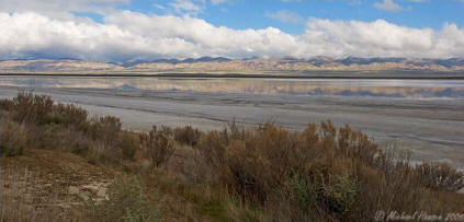
eastern edge of the Carrizo Plain. Soda Lake, a seasonal body of
water, is the centerpiece of the plain. In the heart of the
Carrizo Plain, a sacred Chumash ceremonial site rises 55 feet
from the valley floor. Trails, camp sites, seasonal wildflower
tours, and ample bird-watching opportunities abound. These
unique features and relatively pristine condition make the
Carrizo one of our region’s most unique areas and one highly
deserving of protection.
Wildlife & Wildflowers
The Carrizo Plain is home to one of the largest concentrations
of rare plants and animals in all of California and is vital to
their survival. It is one of the last refuges for the San
Joaquin kit fox, San Joaquin antelope squirrel, burrowing owl,
giant kangaroo rat, and blunt-nosed leopard lizard. The Carrizo
Plain is also prime habitat for pronghorn antelope and Tule elk,
which were once found throughout the deserts and grasslands of
Southern California. The Carrizo Plain also supports golden
eagles and other raptors, and provides winter refuge for
migrating birds, such as American white pelicans, sandhill
cranes, and many species of swans and ducks.
Along with this amazing wildlife diversity, the Carrizo Plain
hosts a diversity of plant communities, including iodine bush,
salt bush scrub, valley grasslands, and California Juniper
woodland. Rare plants like the California jewelflower, Hoover’s
wooly-star, Munz's tidy tips, and pale-yellow layia are found
amidst prolific wildflower blooms each spring, transforming
entire hillsides into vibrant palates of yellow, purple, and
orange.
Soda Lake
The 3,000-acre Soda Lake is one of the plain's most
distinguishing features. The lake has no natural outfall, and
when the water evaporates, it leaves behind a glistening expanse
of minerals that support a unique community of rare plants and
animals. Shorebirds, including thousands of sandhill cranes, as
well as fairy and brine shrimp, depend on the seasonal, briny
water that fills the lake only in the winter. The lake is one of
the largest undisturbed alkali wetlands in California.
Throughout the Carrizo Plain visitors can also find numerous
vernal pools, which support rare plants and animals and spring
wildflowers.
The San Andreas
Fault
In addition to its large diversity of plants and animals, the
Carrizo Plain is also renowned for its amazing geology, which is
in no small part shaped by the San Andreas Fault. The fault
traverses the eastern side of the Carrizo Plain, along the base
of the Temblor Range, altering the course of some streams, most
notably Wallace Creek, and creating “sag ponds,” which trap
rainwater and create habitat for endemic species. The section of
the fault through the Carrizo Plain is recognized as the most
spectacular along the fault’s 800-mile stretch.
 Cultural
Heritage Cultural
Heritage
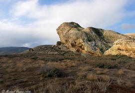
The Chumash, Yokuts, Salinians, and other native peoples made
extensive use of the Carrizo Plain, and left their mark in the
many notable cultural remnants. Native tribes hunted game and
traded amongst one another in the Carrizo Plain, and the history
of these uses is reflected in cultural sites such as Painted
Rock (pictured), which continues to be used for ceremonial
purposes.
Designation as a National Monument
In 2001, the Carrizo Plain National Monument was established by
Presidential Proclamation “so that indigenous species
interact within a dynamic and fully functioning system in
perpetuity while conserving unique natural and cultural
resources and maintaining opportunities for compatible
scientific research, cultural, social and recreational
activities.” Today, the Carrizo Plain is managed cooperatively
by the BLM, the California Department of Fish and Game, and The
Nature Conservancy.
Current Threats
Even though much of the Carrizo Plain is now a National
Monument, the area continues to face significant development
pressures. During the establishment of the National Monument,
oil companies were able to retain underground mineral rights
within the monument boundaries. In 2008, one of these companies
- Vintage Production (a subsidiary of oil giant Occidental
Petroleum) - announced plans to conduct oil exploration
activities in the heart of the Carrizo Plain using 60,000-lb
“thumper trucks” and dynamite. Such exploration techniques would
spell disaster for these lands and the imperiled wildlife found
here, particularly for ground-dwelling animals like the
endangered San Joaquin kit fox. Moreover, Vintage had previously
caused the disastrous 2007 oil spill in the Sespe Condor
Sanctuary along with a dozen other spills in the area. After a
strong community response and serious consideration of the
environmental consequences, the BLM ordered the company to
undertake a comprehensive environmental impact study.
ForestWatch worked alongside a coalition of conservation
organizations in demanding this study.
This isn't the
first time that Big Oil has tried to encroach on the Carrizo. In
2005, the holder of the last remaining undeveloped oil lease in
the monument declared his intention to drill for oil. Because of
our efforts, his lease expired before drilling took place, and
the area known as Wells Canyon is safe for now. In 2007,
ForestWatch also halted a proposal to lease several thousand
acres of land along the monument boundary to oil companies. We
will continue to ensure that oil development does not invade the
quiet solitude of the Carrizo Plain.
A New Vision
for the Carrizo
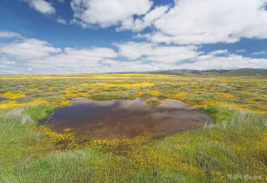
photo © Bill Bouton
When the Carrizo
Plain National Monument was established in 2001, the federal
agency that manages the area - the U.S. Bureau of Land
Management - began work on a management plan for the area. After
a rocky start fraught with delays, the planning process resumed
in 2007. ForestWatch teamed up with a coalition of conservation
organizations - The Wilderness Society, Santa Lucia Chapter of
Sierra Club, Center for Biological Diversity, Natural Resources
Defense Council, California Wilderness Coalition, Defenders of
Wildlife, Californians for Western Wilderness, and Western
Watersheds - to outline our vision for the monument.
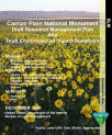
The BLM released a
draft Resource Management Plan in early 2009. When finalized,
the RMP will guide how these lands are managed over the next
decade. While the draft plan is a step in the right direction,
ForestWatch is working with a coalition of organizations to
ensure that the final plan adopts stringent standards for the
protection of this unique and diverse California treasure.
|